


Voting District MARION, Henry County, Ohio
About
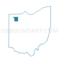
Outline

Summary
| Unique Area Identifier | 647902 |
| Name | Voting District MARION |
| County | Henry County |
| State | Ohio |
| Area (square miles) | 36.30 |
| Land Area (square miles) | 36.30 |
| Water Area (square miles) | 0.01 |
| % of Land Area | 99.99 |
| % of Water Area | 0.01 |
| Latitude of the Internal Point | 41.20931860 |
| Longtitude of the Internal Point | -84.05293250 |
Maps


Graphs
Select a template below for downloading or customizing gragh for Voting District MARION, Henry County, Ohio


Neighbors
Neighoring Voting District (by Name) Neighboring Voting District on the Map
- Voting District BARTLOW, Henry County, OH
- Voting District FLATROCK SOUTH, Henry County, OH
- Voting District MONROE SOUTH, Henry County, OH
- Voting District PLEASANT, Henry County, OH
- PRECINCT LIBERTY TWP. EAST, Putnam County, OH
- PRECINCT LIBERTY TWP. WEST, Putnam County, OH
- PRECINCT PALMER TWP., Putnam County, OH
- PRECINCT VAN BUREN TWP., Putnam County, OH
- Voting District RICHFIELD, Henry County, OH
Top 10 Neighboring County Subdivision (by Population) Neighboring County Subdivision on the Map
- Van Buren township, Putnam County, OH (2,867)
- Bartlow township, Henry County, OH (2,367)
- Pleasant township, Henry County, OH (2,026)
- Liberty township, Putnam County, OH (1,531)
- Marion township, Henry County, OH (1,297)
- Flatrock township, Henry County, OH (1,247)
- Monroe township, Henry County, OH (1,142)
- Palmer township, Putnam County, OH (1,129)
- Richfield township, Henry County, OH (682)
Top 10 Neighboring Place (by Population) Neighboring Place on the Map
Top 10 Neighboring Unified School District (by Population) Neighboring Unified School District on the Map
- Patrick Henry Local School District, OH (5,498)
- Leipsic Local School District, OH (3,621)
- Holgate Local School District, OH (2,490)
- Miller City-New Cleveland Local School District, OH (1,941)
Top 10 Neighboring State Legislative District Lower Chamber (by Population) Neighboring State Legislative District Lower Chamber on the Map
Top 10 Neighboring State Legislative District Upper Chamber (by Population) Neighboring State Legislative District Upper Chamber on the Map
Top 10 Neighboring 111th Congressional District (by Population) Neighboring 111th Congressional District on the Map
Top 10 Neighboring Census Tract (by Population) Neighboring Census Tract on the Map
- Census Tract 302, Putnam County, OH (5,823)
- Census Tract 301, Putnam County, OH (4,398)
- Census Tract 7, Henry County, OH (4,151)
- Census Tract 6, Henry County, OH (3,569)
- Census Tract 5, Henry County, OH (3,404)